Marker Buoys
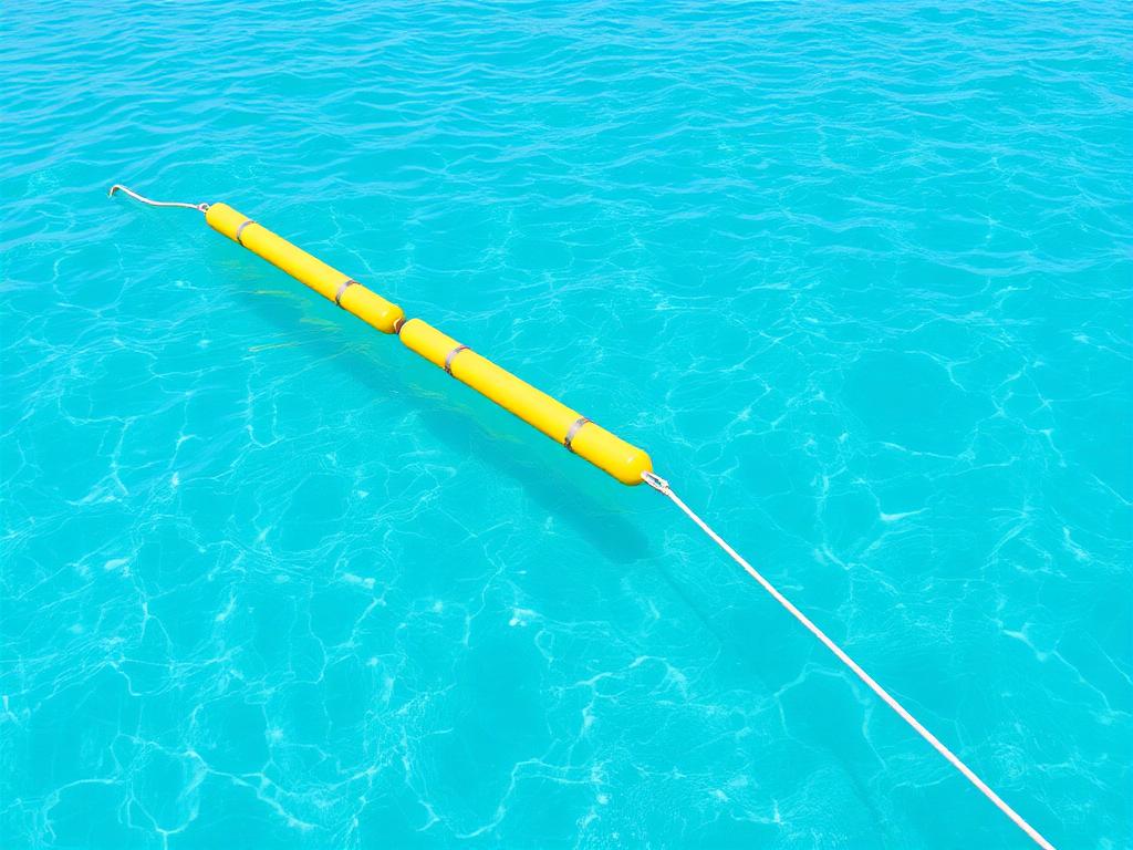
At Grupo Eleven Solutions®, we deliver specialized marine engineering services to structure and safeguard beach fronts and navigation access throughout the Mexican Caribbean. Deploying demarcation marker buoys prevents hazardous accidents by strictly separating swimming zones from boat and watercraft transit corridors. Our technical team integrates sustainable coastal management methodologies and GIS geographical monitoring systems, ensuring buoyant markers remain stable, highly visible, and fully aligned with environmental safety practices.
We design tailored mooring and demarcation arrays adapted to local bathymetric and hydrodynamic parameters. With proven regional experience across the Riviera Maya and partnerships with premier developments such as Corasol and Moxché, we install durable marine buoys that endure wave action while protecting delicate seabed ecosystems. Whether serving luxury resorts, residential communities, or marinas, our solutions enhance waterfront safety and provide seamless navigational control.
What are marker buoys and why are they essential?
Marker buoys are moored marine floating devices strategically installed to physically delineate coastal zones. Their fundamental function is establishing a safe barrier between designated swimmer areas and active navigation channels for boats, tenders, and jet skis. On high-traffic resort coastlines, these visible markers prevent maritime collisions, safeguard guests, and create organized, predictable entry and exit routes toward marinas, docks, and coastal facilities.
Built with UV-resistant materials and heavy-duty mooring lines, our buoy systems are engineered to withstand tropical saltwater conditions without drift. Grupo Eleven Solutions® utilizes GIS mapping to position each anchor block and float accurately according to hydrodynamic models. This engineering approach maintains channel clarity and swimmer protection without damaging native marine flora or disrupting the natural sediment dynamics of local beaches.
Request a quote
Our process Marker Buoys
Bathymetric survey & GIS planning
We assess water depths, seabed morphology, and hydrodynamic conditions using GIS mapping to calculate exact coordinates for navigation channels and swim zones.
Mooring & buoy specification
We determine the appropriate anchor weights, chain lengths, and buoy types, selecting resilient materials capable of resisting localized currents and wave action.
Marine deployment & anchoring
Our marine crew deploys anchoring deadweights and connects marker buoys at designated points, calibrating line tension for optimal flotation and visibility.
Geopositioning verification
We inspect the entire demarcation perimeter, confirming precise GPS alignment and checking that navigation corridors and beach boundaries function safely and effectively.
Benefits
Industries served
Coverage in Quintana Roo
Grupo Eleven Solutions® provides marker buoy installation across Cancún, Playa del Carmen, Tulum, Riviera Maya, and Quintana Roo. Our extensive knowledge of local Caribbean waters allows us to execute marine projects swiftly and reliably. We support coastal resorts, residential communities, and marinas with demarcation systems engineered to maintain waterway safety and withstand regional marine dynamics.
Frequently asked questions
Why is separating swimming areas from boat channels crucial?
Demarcating these spaces prevents severe accidents between swimmers and motorized vessels. It sets up designated maritime transit corridors, ensuring boats and jet skis operate safely away from beachfront recreation zones and resort guests.
How are anchoring systems selected for marker buoys?
Anchor systems are engineered based on site bathymetry, current strength, and seabed conditions. We select stable deadweights and lines that keep buoys firmly positioned without sliding or causing unnecessary disturbance to benthic habitats.
What role does GIS monitoring play in buoy placement?
GIS mapping ensures accurate georeferenced placement according to project layouts and nautical regulations. It also enables structured maintenance logs, making it simple to track line integrity and monitor buoy coordinates over time.
Can buoy systems be installed in protected coastal areas?
Yes. We work in protected natural areas, marinas, and ports using low-impact marine engineering techniques designed to regulate nautical traffic while respecting sensitive aquatic ecosystems and shoreline conservation standards.
Need this service? Get expert advice with no obligation.
Request a quoteMore services in Maritime Engineering
Beach Restoration
Comprehensive coastal restoration and beach profile stabilization
Beach and Sargassum Cleaning
Advanced mechanical sargassum harvesting preserving native beach sand
Coastal Dune Reforestation
Ecological restoration and resilient shoreline protection systems
Sargassum Barriers
Floating marine containment barriers for luxury coastal hospitality
Oil Spill Barriers
Containment and dispersion systems for offshore oil spills
Vessel Recovery
Technical salvage for grounded and submerged vessels
Water Hyacinth Control
Sustainable aquatic vegetation management for lagoons and cenotes
Environmental Management
Sustainable solutions for marine and coastal ecosystem preservation